 Norsk
Norsk
Treskelen [77° 00.5' N 16° 15' E]By Øystein Overrein (ed.), Jørn Henriksen, Bjørn Fossli Johansen, Kristin PrestvoldThe dramatic landscape at Treskelen has views towards Brepollen at the end of Hornsund and west towards the rest of the fjord. In the southern parts of Treskelen the bedrock is covered by moraine material from the time when the glaciers reached all the way out to there. Treskelen offers insights into the special geology of the area and the chances of observing fossils are good. 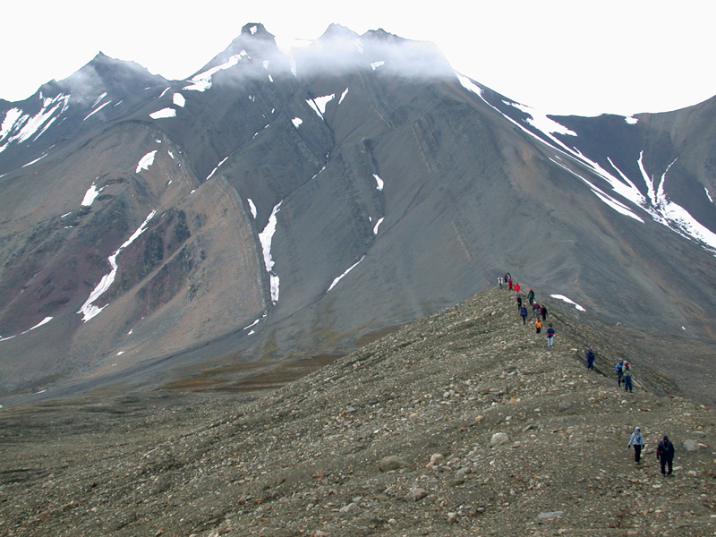 Take care:
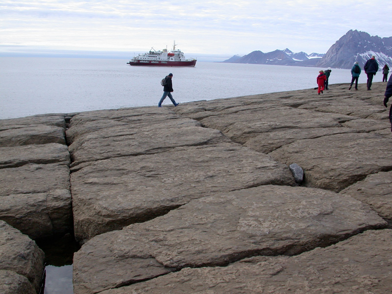
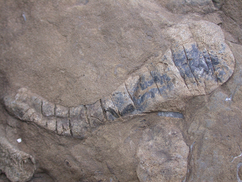
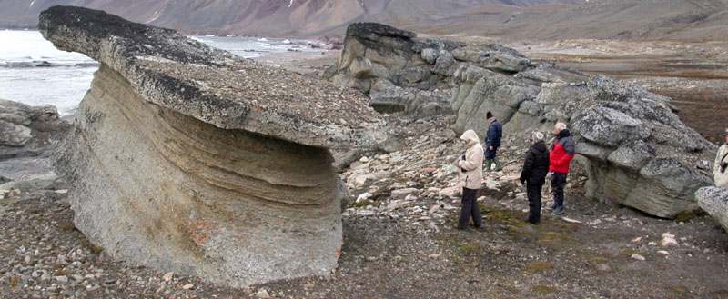
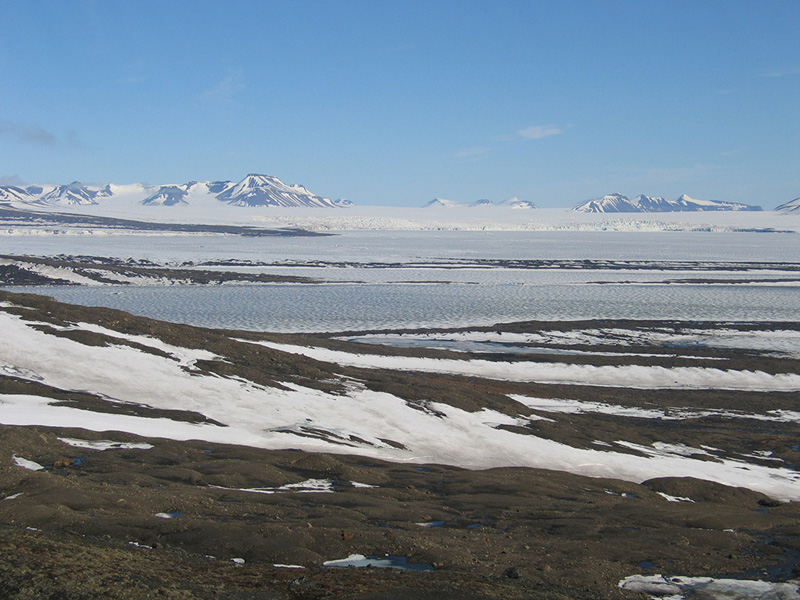
On the face of Hyrnefjellet you see distinct colours that clearly show how the mountain is folded. The fold arcs upwards, which is called an anticline in geological terms (as opposed to a syncline which folds downwards). The red is sandstone and conglomerates from the Carboniferous period; the yellowish brown colour is fine conglomerates containing limestone from the Permian period. The darkest, greyish layer is a combination of sandstone and clay shale from the Triassic period. Treskelen is the continuation of the eastern flank of the anticline in Hyrnefjellet. The bedrock is tilted up with a slight angle towards the east. After landing at Treskelen, you can hike up to and come close to the geological layers. You will find fantastic conglomerates and places with fossils. Even fossils from corals are found in the area. Towards the southern point of Treskelen you will find a quite large flat area that is broken up into blocks that gradually tilt into the sea. These yellowish brown blocks are easy to walk on. If you bend down you’ll see that there are thousands of fossil animals embedded in the blocks: brachiopods, mussels, sponges, sea lilies and trilobites. Treskelen is easily accessible and is not particularly vulnerable to wear and tear caused by human visitors. An exception is in the northern parts of Treskelen where you must try to avoid the vulnerable moss tundra. Towards Treskelodden (the southern tip) there are soft and wet areas where there is a danger of sinking in. Here you will find good examples of the permafrost phenomena called solifluction, in which the upper, waterlogged layer of soil is sliding over the underlying, permanently frozen soil. Vulnerable elementsBe careful of the moss tundra at the north-west side of Treskelen and whatever cultural remains you encounter. Landing sitesThere is often a quite strong breeze from the east in Hornsund. If that is the case a landing on the west side of Treskelen is ideal, as you will be on the sheltered side. Land at the pebble beach a few hundred metres in from the point of Treskelodden. Alternatively you can land at the end of Adriabukta, but be aware of the many sunken rocks there. Recommended trailsA good hike is along the whole headland of Treskelen in a north-south direction. A good option is to follow the coast in one direction, and hike back along the ridge. Along the ridge of Treskelen you get a great view. Updated March 2015 |
The Cruise Handbook is also available in book formHard cover with numerous pictures - 249 pages - NOK 249.00 Norwegian Polar Institute |