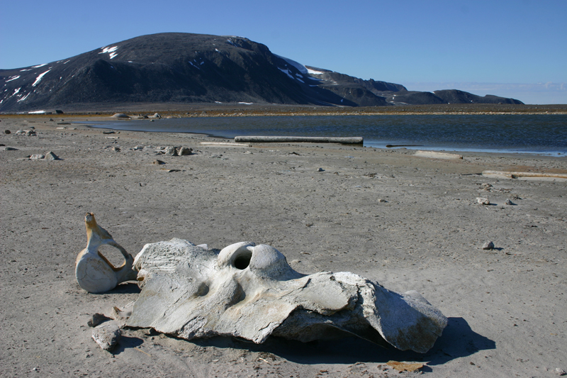
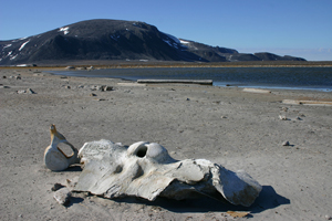
 Whale bones by Smeerenburg on Amsterdamøya remind us of the exploitation that took place in earlier times. In the background the characteristic rounded profile of Hollendarberget can be seen. (Image: Bjørn Fossli Johansen / The Norwegian Polar Institute)
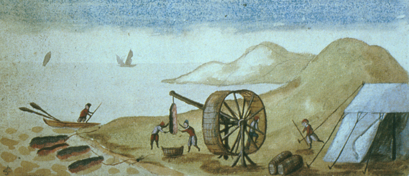
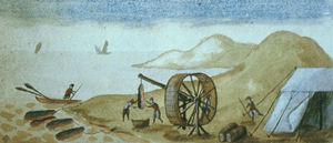 The flensing of the whale completed, the blubber was brought to shore. It was then chopped into small pieces and boiled in large copper cooking vessels in blubber ovens until it became oil. (Image: Watercolour by Fotherby, 1613)
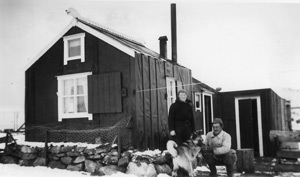 Sallyhamna around 1940 with Sally and Waldemar Kræmer. Take note of the carved bear head on the ridge. (Image: Gunnar Aasgaard / The Norwegian Polar Institute)
“We hope that the Lord with a blessed journey keep us and return again to our fatherland. Each one to his (loved) ones.”
(Wij hoope dat de Heere ons met een gesegende reys behouden in ons vaterlant zal weder brengen. Een ieder bij de zijne.) This quotation comes from the journal of the Dutch ship, Weltevreede, commanded by Cornelius de Leeuw, sailing for the merchant Simon Beets. The year was 1777 (archives of the Svalbard Museum).
In June 1596, a snow-covered land with tall, pointy mountains was discovered by the Dutch cartographer, navigator and explorer Willem Barentsz. Barentsgattet, which is believed to be the place where Barentsz moored on 21 June 1596, is located between two of the islands, Fuglesongen and Klovningen. He made a description of Klovningen, and thought the island was a good landmark, given its appearance. The characteristic mountain formations eventually gave the archipelago its name: Spitzbergen (in Norwegian: Spitsbergen). Parts of the area that was to become known as Svalbard was printed on the world map for the first time under the name of “Het Nieuwe Land” – The New Land.
The discovery of this new land was initially of small practical significance. It was when Henry Hudson described the place in 1607, and its abundance of whales, seals and walrus in the waters surrounding the archipelago, that it became interesting. In the first few years it was popular to catch walrus, but in 1611 whaling began to predominate, and the north-western corner of Spitsbergen became the core area for whaling in Svalbard. All through the 1600s and 1700s, English, Dutch, Danish/Norwegian and Basque ships sailed to the area, where the whales tended to gather in large groups during the summer. A lot of activity took place during these few hectic months each year.
For nearly 200 years this international harvest of whales in the sea by the land with the sharp, snow-covered mountains took place. In the beginning the whale tended to go into the fjords, and large whaling stations were built onshore to boil the blubber and to produce the profitable oil. During those years the fjords must have been full of floating whale carcasses, smoke from the ovens at the whaling stations, sailing ships mooring in safe bays by the stations and small boats on the sea, hunting for whales. The carcasses inevitably attracted mammals and birds. The landscape was full of men working at the whaling station and looking out for whales. Not until tourism made its appearance several centuries later have so many people occupied this landscape as during whaling in the first half of the 1600s. The number of people decreased dramatically once overwintering hunting took over several decades later. The walrus hunters and the trappers who overwintered left small, scattered footprints in the enormous, beautiful and wild scenery.
The whales eventually left the fjords behind and began to move towards the ice edge and between north-western Spitsbergen and Greenland. The hunting vessels followed the whales and the whaling stations were abandoned. However, Nordvesthjørnet, with its comfortable bays and its good harbours, remained in use until the end of whaling towards the latter part of the 1700s. The area was used as a place to moor while waiting for the conditions to become right for hunting near the ice edge. It was also where hunting vessels fathered before the season began and after it had ended. Utensils and equipment were stored here, and there was also a burial ground.
The whalers greatly appreciated the bays and good anchorages the area offered. Phipp’s expedition in 1773 is worth mentioning as an example. The expedition had to wait for the sea ice condition to improve, and did so near Fair Haven. Here. Several other whalers were also waiting to leave the fjord and hunt whales by the ice edge. According to Phipps, the best time to do it was in July and the first 10 days of August.
In Phipp’s days, Fair Haven was the name of the area by the row of islands that make the northern border of Spitsbergen. Fair Haven was mentioned for the first time in 1610, when Poole used it when referring to what is now known as Sørgattet. The name Fair Haven was soon expanded by English sailors to include all good mooring sites around Danskøya and Amsterdamøya. The name was more a description of calm waters and a good port than the name of a specific place. The different moorings were soon given their own, individual names, and in Muscovy Company’s map from 1625 it looks as though the name Fair Haven was used for Fuglefjorden.
Whaling stations
From Magdalenefjorden in the south to Reinsdyrflya in the north-east, traces can still be found of the whaling that was once carried out here. Remains of the old whaling stations lie scattered along the entire coastline, like pearls on a string. The largest and most well-known stations in Svalbard were all situated in Nordvesthjørnet. Examples being the Dutch station at Smeerenburg on Amsterdamøya.
Other large stations could be found in Magdalenefjorden, Smeerenburgfjorden, Kobbefjorden, Virgohamna and Sallyhamna and on Ytre Norskøya, to mention a few.
The whaling station in Sallyhamna was large, and remains of blubber ovens and foundations for cooling and cleansing pans, used in preparing the whale oil, can be found. A roughly laid road leads the way from the blubber oven by Svenskegattet to the sandy beach in Sallyhamna. Here, there is a small foundation. The area around the ovens is almost free of rocks, which could be down to the fact that the ovens were built using rocks. It is also possible that the area was cleared of rocks to make it more suitable for the activity that was happening there. In this stoneless area there are foundations remaining from the simple structures that served as shelter during this early period. Pieces of ceramics and clay pipes can be found, supporting the assumption that these were housing constructions. There are secondary graves consisting of coffin boards placed in the blubber ovens, but there are no remains of skeletons.
The whaling station in the fjord Kobbefjorden is also worth mentioning as an example of a station from the 1600s situated in Nordvesthjørnet. Kobbefjorden is to the west of Danskøya. According to Nordenskiöld, Kobbefjorden was the fjord in which the ice thawed quickly in the summer, and he claimed that at the end of the fjord there was a fresh water source that never froze. The fjord has been known under many different names. In the early days of the whaling in the 1600s it was known as Robbe Bay, Port St. Pierre and Copenhavre Bay – a name believed to have been bestowed on it after the Danish established a whaling station in the southern part of the fjord in 1625. There is also an islet in Kobbefjorden called Postholmen: when ships returned from home the crew left post here for the others that were catching whales in the area. Homebound ships stopped at the islet to pick up any post addressed to home.
Whaling graves
Whaling was dangerous and human lives were easily lost. In the areas around the whaling stations single graves as well as large areas containing several hundred graves can be found. The largest of these are situated in Nordvesthjørnet. The largest area of graves of them all, Likneset, is located just across the fjord from the Dutch whaling town Smeerenburg. The area here consists of 225 graves topped by high mounds of stones that are easily noticed in the landscape. The burial ground is on a low gravel elevation with a steep and active erosion brim towards the sea. It is believed that the number of graves in this whaling cemetery was once much larger than it is today. The fjord may be very exposed, and during the course of the years the weather has led to several graves disappearing into the sea. It is possible that more graves may be eroded at some point. This disappearance of graves into the sea below the cemetery was the reason that archaeological digs were carried out here in 1985, 1986, 1989 and 1990.
It is believed that the cemetery at Likneset was in use from the early 1600s to the late 1700s. The large grave areas during the whaling period can be put down to the fact that the whaling ships gathered in good ports at the end of each season. This is when funerals were carried out.
The grave area at Likneset is vulnerable. It is not desirable for people to enter it. Environmental authorities are contemplating a restriction against going ashore here.
A trapper’s life
The north-western corner of Spitsbergen has been used as a territory for trapping by Norwegian and Russian trappers who overwintered. They left many cultural treasures in the form of buildings, foundations, shipwrecks, equipment and utensils, traps and graves. However, this area was not as frequently used as other areas further south along the west coast of Spitsbergen during these periods of Svalbard’s history.
By the channel Svenskegattet are the remains of an old Russian trapper’s station, consisting of two foundations. Nearby are the remains of a Norwegian trapper’s hut. This hut was the main base in this area from the early 1920s. It was abandoned after Waldemar Kræmer erected the new main station in Sallyhamna in 1937.
Beautifully situated in the narrow channel Sørgattet is Bjørnhamna. This Norwegian main trapping station was probably erected in 1925. By the cabin is a sheltered lagoon, perfect as a port. The main station consists of several outbuildings, a capstan for boats and other equipment. This is one of the few trapping stations where the old interior design is well preserved. The main station was fixed up in 1994 and 1995 by the Governor of Svalbard. It is regularly maintained.
Would you like to sail to cold Greenland [Svalbard]
for whale, walrus, bear and blubber oil
you should go easy on the brandy
put on plenty of all sorts of clothes.
(Wilt gij na`t coude Groenlant vaare
om walvis robbe beer en traan,
wilt gij uw brandewijn wat spaare
trekt lustig bonte kleeren aan.)
From the journal of the Weltevreede, 1777 (archives of the Svalbard Museum).
 Norsk
Norsk