 Norsk
Norsk
Signehamna [79° 16.4' N 11° 33' E]By Øystein Overrein (ed.), Jørn Henriksen, Bjørn Fossli Johansen, Kristin PrestvoldThe harbour of Signehamna is an area of natural beauty far into the fjord of Krossfjorden. Here lie the remains of a German weather station from World War II. The bird cliff in the area is lively and adds a lush, green colouration to the landscape. 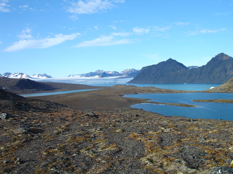 Take care:
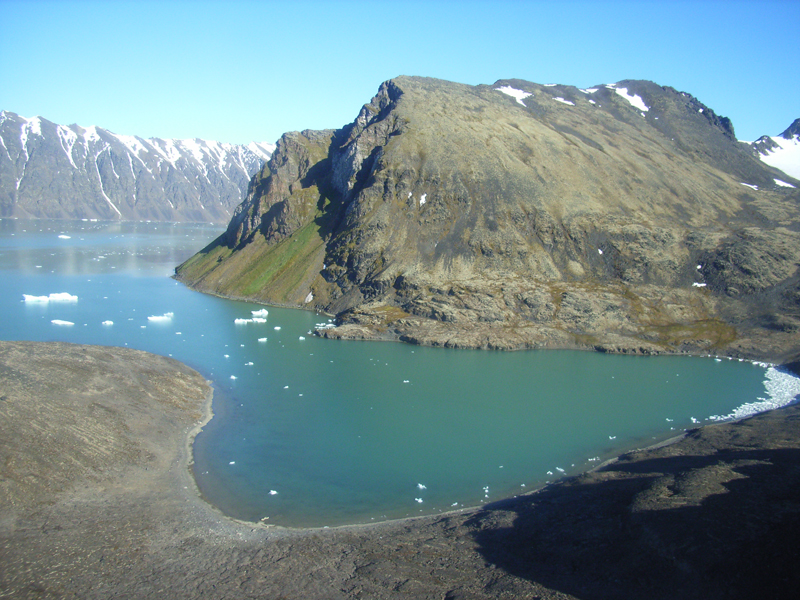
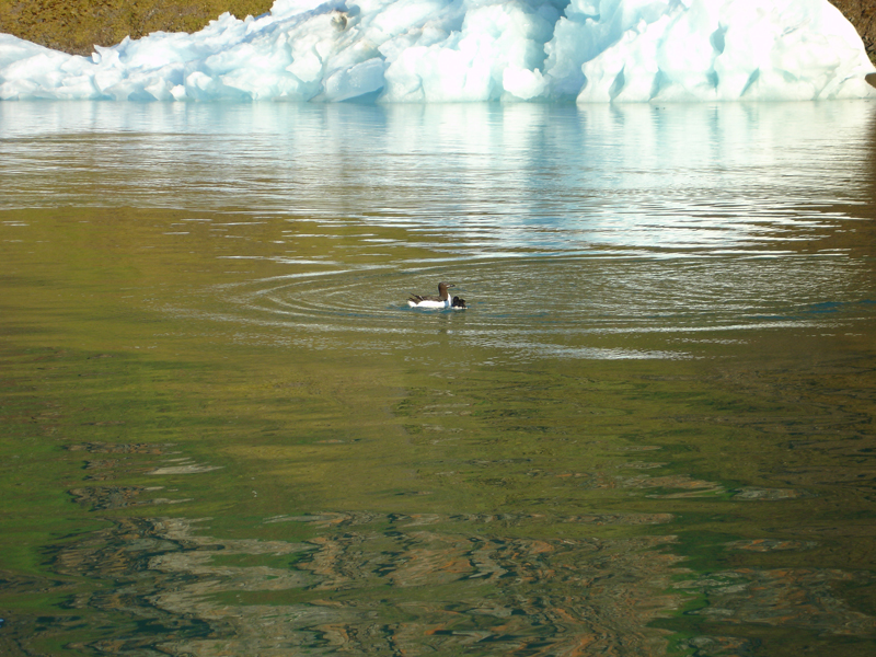
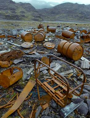
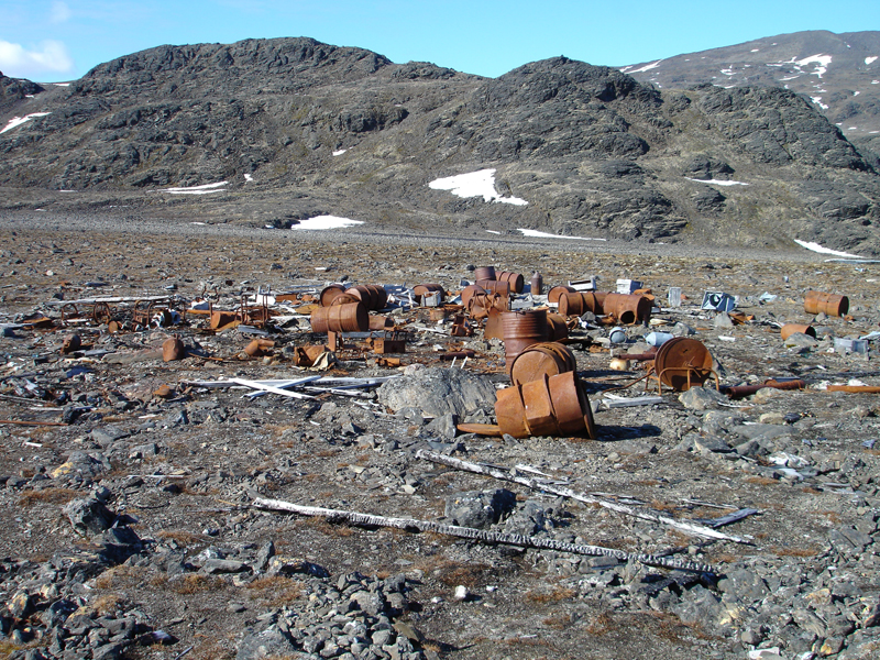
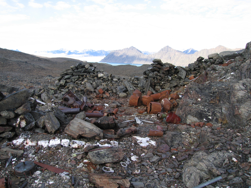
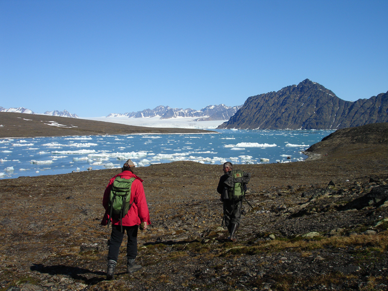
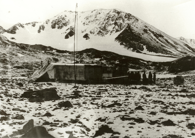
Signehamna is a bay at the outlet of a south-west directed valley that cuts through the entire peninsula of Mitrahalvøya. The mountainsides in the north and south are steep with minor glaciers in between. On the south side lies a small lake named Hajaren. Both Hajeren and Erlingvatnet further in have populations of Arctic char. Just south of Signehamna lies the inlet of Nilspollen at the foot of a lush green bird cliff named Nilspynten. Kittiwakes, little auks and Brünnich’s guillemots dominate here; Atlantic puffins and black guillemots are also found. The area has sparse vegetation, mostly mosses, lichens, salixes and sedges. There are also areas of patterned ground. Signehamna and the battle of the weather stationsSignehamna is located at the west side of the fjord of Lilliehöökfjorden, and was named after Gunnar Isachsen’s wife Signe. Captain Isachsen mapped the area in 1906 and 1907, partly financed by Prince Albert of Monaco. However, it was neither Gunnar Isachsen’s Signe nor Prince Albert of Monaco who made Signehamna famous. In this beautiful and sheltered bay, with a good harbour and teeming birdlife on the cliffs, the German marine weather station Knospe was established during World War II. Knospe was named after Hans-Robert Knoespel, who in 1941 launched the idea to build landbased stations for weather forecasting after a number of German weather ships and airplanes had been sunken and shot down during retrieval of meteorological information. Knoespel found that landbased stations would be more protected against attacks. In winter, the pack ice and the dark polar night would give protection. Six men were stationed at Signehamna from mid-October 1941. They built the weather station and throughout the winter they collected all types of weather data that the German war administration considered important with respect to the war in Europe. Knospe was operational all winter and was replaced in the autumn of 1942 by Nussbaum at the approximately same location. With that, much of the same equipment could be reused. However, the allied forces had been informed of the position of the weather station, and this was not known to the Germans. During the autumn of 1942 the Norwegians made several attempts to reach the station, but were hindered by the weather. In June 1943, Nussbaum was found by Norwegian troops based in Barentsburg. In the short battle that followed, one of the Germans killed himself to avoid being taken prisoner, according to one source. Other sources state that he was killed by the Norwegians. One of the Norwegians drowned when trying to swim away from a ship that was fired on by a German submarine. Covering a large area, the Germans built a winter station, a summer station, an automatic weather station and a number of emergency and evacuation depots in and around Signehamna. To protect it, the weather station in Signehamna was hidden behind the ridge nearest to the bay and could not be seen from the fjord. On the ridge, with a view of the bay, lie the remains of the automatic weather station in the form of round iron containers and poles from the battery drums as well as bipods for the antenna. The other pieces of the station are gone. Some hundred metres further inland, toward the lake of Hajeren, lies what is left of the manned weather station Knospe, not more than a ruin today. It was exploded and burnt by the Norwegian forces in 1943 and left to natural and human degradation. What is left are fragments of past times, telling the story of the activities that once took place here. Dispersed in a concentrated area are heaps of iron, remains of station buildings, technical equipment, kitchen utensils and personal belongings. There is a wide range of different objects, like fuel drums marked Kriegsmarine, cables, wooden boxes and iron barrels. Incidentally, there are remains of aggregates, rusty tools, zinc buckets and jerricans full of broken glass, cups, plates, tin cans, cartridge cases, ski bindings and pieces of tent canvas. The contrast between the remains and the magnificent natural environment may offend one’s sensibilities. Cultural remains are not necessarily beautiful or related to favourable historical happenings. Cultural remains can just as well be disgraceful and unpleasant. Beauty is not the only factor that can add value to cultural remains. Often, the opposite can be more interesting and dramatic stories are represented, such as at Signehamna. The history, location and the cultural remains of the Knospe and Nussbaum clearly show how the war in Svalbard was actually a battle over the weather, a battle for information that was crucial to the rest of Europe. Signehamna is part of Svalbard’s recent history and a cultural heritage site that should be treated with respect. Experience the site, but do not touch or disturb the place. Vulnerable elementsThe cultural remains in this area consist of a number of loose objects. Keep your distance and do not walk among the objects. Leave the objects in place. Take pictures to remember the place. Landing sitesTo visit the German weather station, the best landing site is on the south side of Signehamna, in the bay just in from the point of Gunnarpynten. An alternative landing site is innermost in the inlet of Nilspollen. From Signehamna there is a track leading up to the summer station. If landing in Nilspollen follow the track on the north side of Hajeren to the station. There is also a track around the lake. Recommended trailsThere are several viewpoints to choose from. The closest viewpoint is at the top of the point north of Nilspollen. If you walk further, you can have a good overview from the ridge west of Hajeren. Updated May 2015 |
The Cruise Handbook is also available in book formHard cover with numerous pictures - 249 pages - NOK 249.00 Norwegian Polar Institute |